Contact form
Your request has been sent.
Please enter your name
Please enter your email
Please enter a correct email address
Please enter your company name
Please enter your message
XERUS
AI solution for military mapping
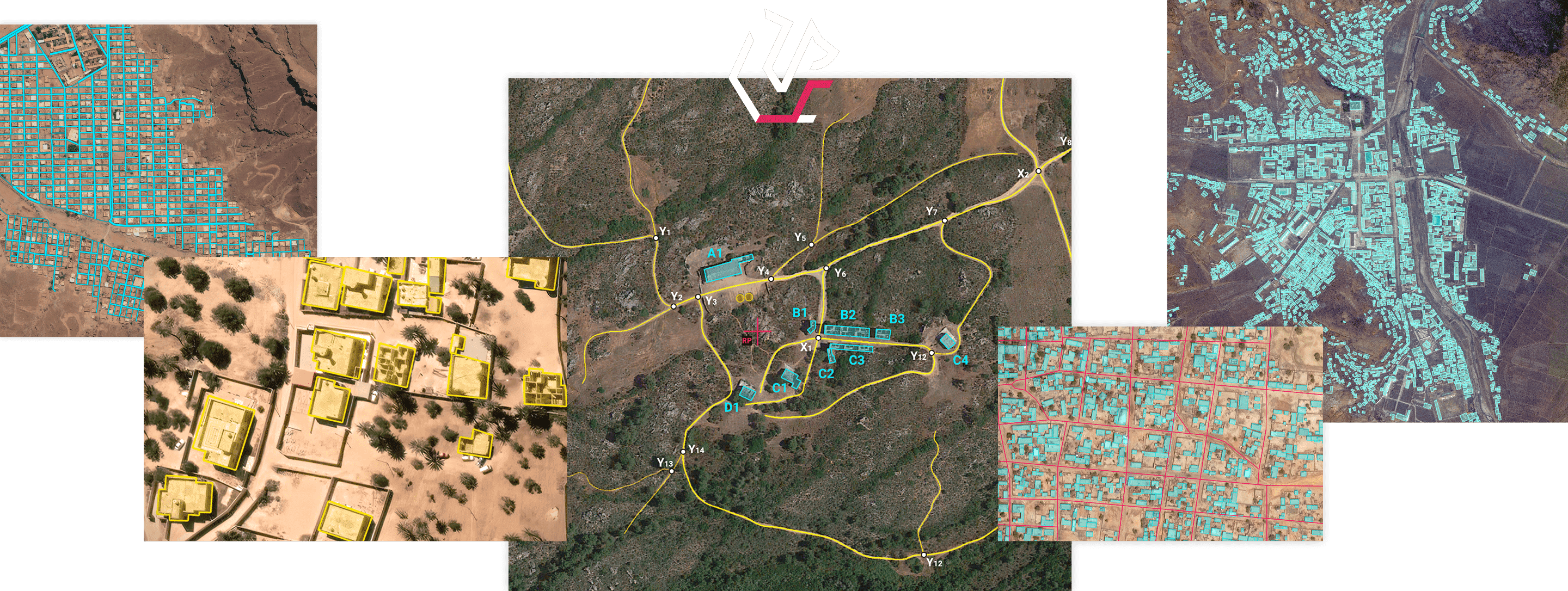
A powerful AI solution leveraging EHR/VHR optical satellite imagery to detect and vectorize roads, buildings and barriers in record time.
This is Xerus.
A POWERFUL AI MAPPING SOLUTION
By combining three best-in-class detectors - the Road Detector, the Building Detector & the Barrier detector - with vectorization modules, Xerus enables the rapid mapping of urban, desertic and sparse-dense areas of operation and provides key analytical data.


AUTOMATIC VECTORIZATION
Automatically vectorize roads, buildings and barriers from any area of interest starting from a satellite image.

MISSION PREPARATION AND SPOT MAPPING
Roads and buildings are named logically upon their location.

CHANGE STUDY
Compare vectorizations over time to spot major changes in an area of interest.

KEY DATA EXTRACTION
Metadata such as road widths, number / area of buildings and total built-up area comes with vectorization and can be exploited in a GIS.
Play